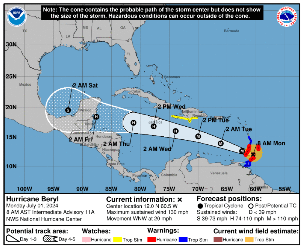
Hurricane Beryl reached category 4 on Sunday, synonymous with “extremely dangerous,” with winds of more than 200 kilometers per hour, which carry “potentially deadly” risks over the Antilles.
Both the Ministry of the Environment and the General Directorate of Civil Protection advanced that Hurricane “Beryl” will bring consequences to the country, from next Thursday the headlines of both institutions advanced, on Monday morning.
We have been monitoring with the Ministry of the Environment, the cone in its maximum expression, reaching Belize, reaching the Atlantic coast of Honduras, would undoubtedly reach a very wide distance, then those same situations will cause me to generate a drag of humidity from the Pacific, which would be leaving us, according to the models, a good amount of rain between Thursday and Friday, said the director of Civil Protection, Luis Amaya.
The official explained that according to the characteristics of the hurricanes that advance very quickly the impact is caused by between one and three days, in this case for El Salvador the impact should be coming on Wednesday night, Thursday in the early morning and a little on Friday.

Beryl wind trajectory according to the National Hurricane Center.
He added that the amount of rain he could have in those two days, could be between 200, 250 millimeters.
For his part, the Minister of the Environment, Fernando López, also confirmed the influence of Hurricane Bray to El Salvador from Thursday. However, he pointed out that the system moves at a slow pace and as it approaches Central America it could be degraded to a lower category.
Currently, Beryl has arrived in the Lesser Antilles, where the island of Tobago is in a state of emergency, and the neighbouring islands on alert.
Lopez added that the rest of the week there will be rains, but in the afternoons, after tropical storm Chris dissies in Mexico and stopped affecting the country.
This article has been translated after first appearing in Diario El Mundo


